

Over the last few years, we were fortunate to explore the Southwestern part of the United States. Our first trip started in Wyoming, and ended in Arizona. With our excitement to get out of the Bay Area and road-trip, we eagerly hiked and explored without a peep on this website. It’s a little funny to have a travel blog, and not mention traveling. That first trip inspired us to do similar road-trips, visiting as many National Parks as we could fit in a 3 week time frame as possible. So, without further ado, we present to you- Geoff and Dava’s Southwest Road-Trip Series.
If you want to be technical, our 2018 trip started after a night in Bakersfield, CA, but if you’ve ever been to that part of California, you’d understand why there’s nothing to report. After a four-hour drive from SF, to Bakersfield, we continued to head southeast to VegasBABY! We did Vegas proper and stayed on the outskirts, and drove right through the next morning to head to Utah. We didn’t even put a dollar in a gambling machine. We kind of gets little crazy on our trips…
Vegas is only 3.5 hours from Kanab, Utah, our first true stop. We stayed in Kanab the year before and enjoyed it so much we chose to stay at the same place the next year. We also used the same tour company we used the year prior. Thanks, Dreamland Safari Tours! Though we tried for The Wave for a second year in a row and didn’t get it, it wasn’t anything to cry home about. Our tour guide, Steve, made the trip out to the Vermillion Cliffs and White Pocket (a non-permit tour) well worth a full day of exploring. Even though White Pocket is about a square mile in size, it provided us with a lot of hiking terrain and surreal views overlooking the Coyote Buttes and Buckskin Gulch.
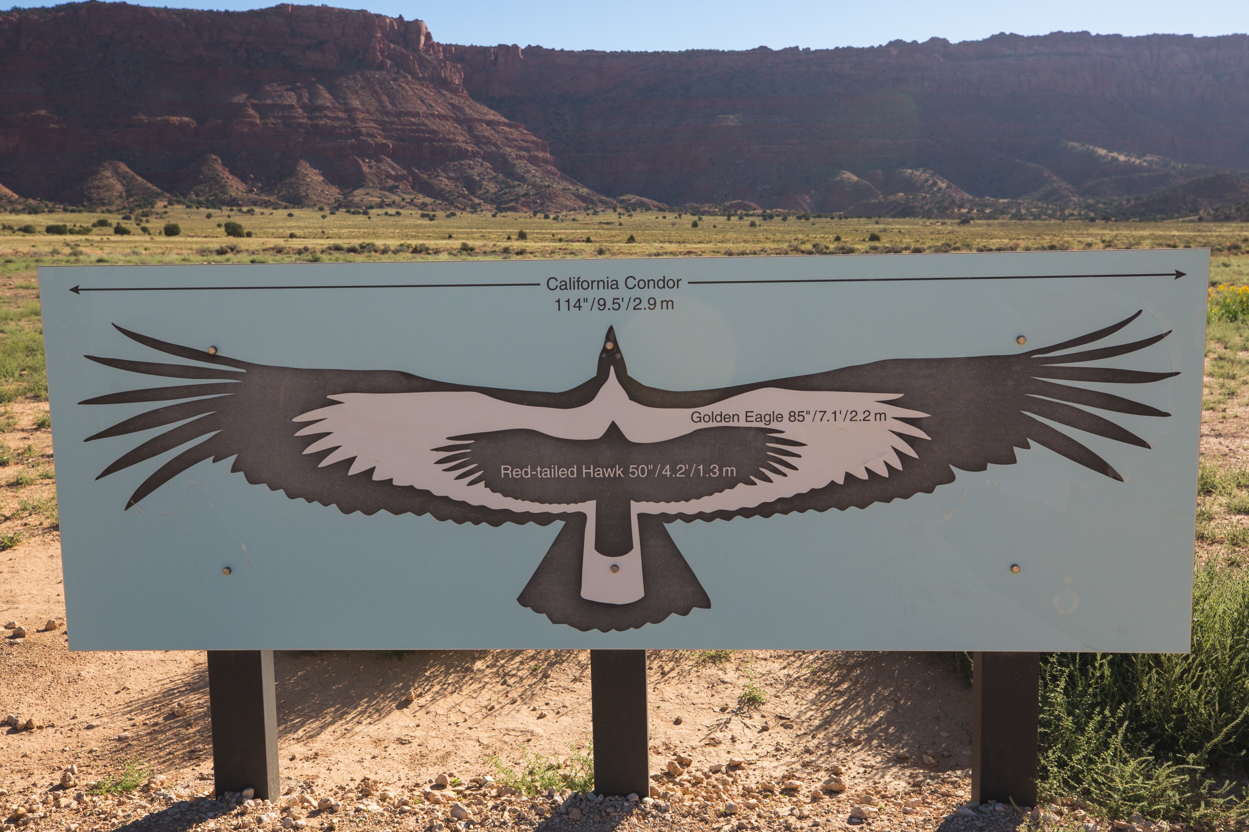
Once we got picked up bright and early that morning, we headed out to Vermillion Cliffs with our new friends that opted for the same tour, and our trusty tour guide, Steve. The drive out to Vermillion Cliffs took about 1.5 hours from Kanab, Utah, with most of it being on paved highway. It got a little bumpy when we turned on a dirt road, but still smooth enough to drink a cup of coffee. We were able to pull off to a small space on the side of the dirt road that provided information on the California Condor, beautiful views of open space, and a bathroom. With the condor being a vulture, it’s named the largest North American bird. Their incredible size is only truly appreciated when you get to see them for yourself. Luckily, this small rest stop provided a telescope that allowed us to see just how giant these birds really were, even from a quarter-mile!

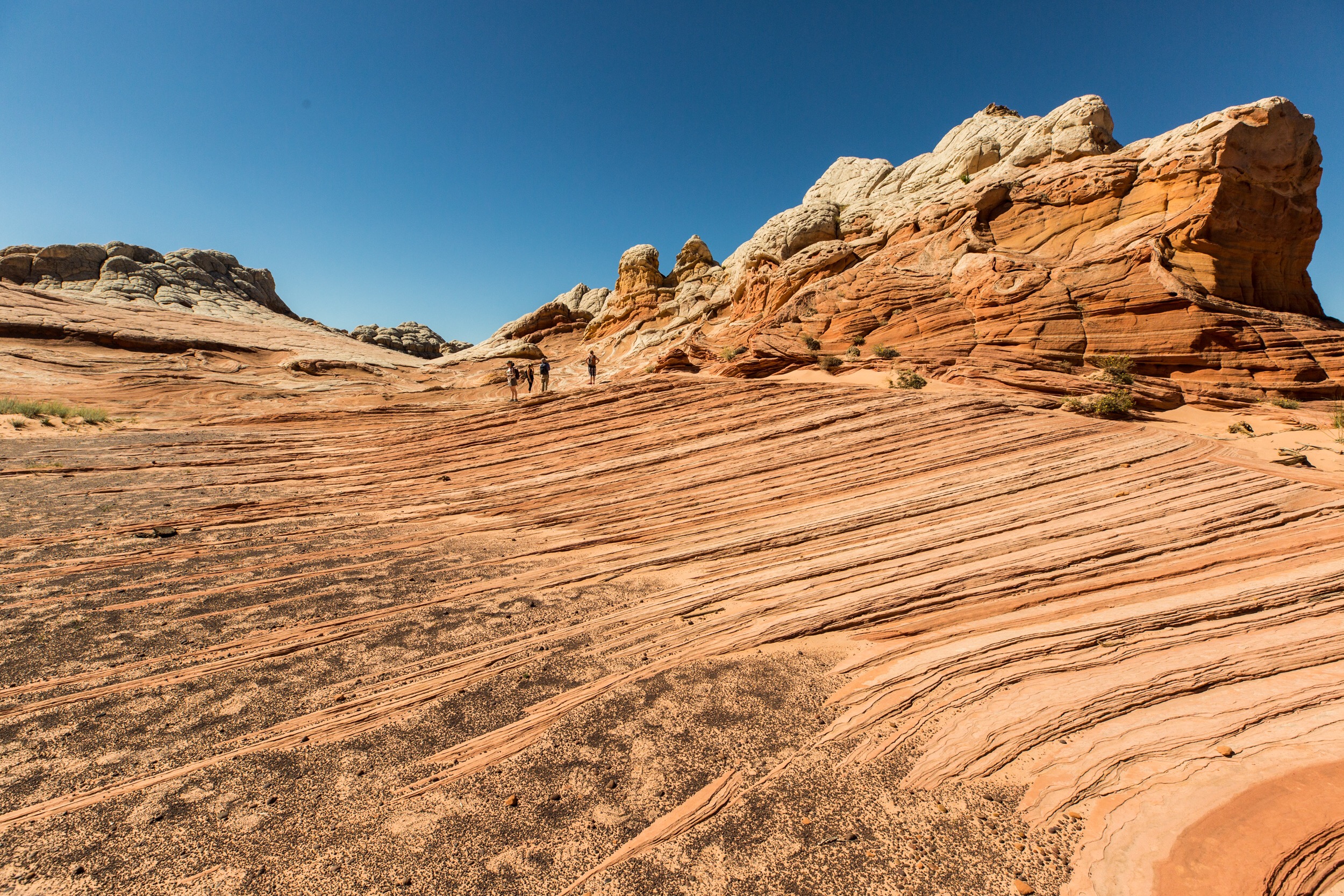
The drive to the trailhead of White Pocket gets slightly dicey once you’re off the paved highway and dirt road. We learned that tire pressure is good around 34psi in each before going on very soft sandy terrain. It took another 45 minutes to get to the beginning of our destination and we were all pretty happy to get out of the 4-wheel drive vehicle at this point. Our surroundings quickly changed from open space, to tall rocky mounds. White Pocket is known for the white “brain domes”, hoodoo structures, and red/orange gully’s that take you on a visual ride through the local earth history.
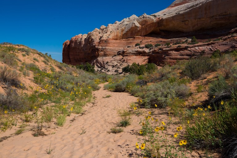
To be honest, the trailhead to White Pocket doesn’t look like much. There’s a small clearing for cars and a large, red stone cliff surrounded by heat and dry hearty vegetation. We took a brief detour to look at some petroglyphs- mostly Native American people informing each other that there are deer around- and then we moved on to White Pocket.
The earth’s dynamic forces were on full display here. It’s really tough to explain what it looks like other than to say that the land here looks twisted and warped. There are huge, long striations of different bands of rock that abruptly end in what looks like knots. There are reds and whites twisted together like ribbons, woven into a strange, otherworldly tapestry. It really does feel like standing on an alien planet. It even has Moqui Marbles (similar to what has been found on Mars!). Check out the lower left area of the picture above. There are thousands of these little sandstones covered in iron oxide balls.
If you’re into earth history, strange rock formations seen in very few places on the planet or something different than Zion or Bryce, this is the place for you. The hike itself isn’t bad at all, although when we were here it was 90+ degrees and very dry. Figure out how much water you think you need and then double it. The hardest part about this hike is getting there. It’s a moderately long, poorly marked dirt and deep sand road that should only be driven by experienced drivers. Getting someone else to do the driving will cost you about 1500 dollars less than getting a tow truck to help you when you get stuck.

Have you been to White Pocket? Share your experience with us!
